This work is licensed under a Creative Commons Attribution-ShareAlike 4.0 International License

GPS
Finding a location

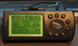
During incidents, CFS appliances need to know where they need to travel to, or notify where they are. They use GPS (Global Position System) Units to determine their position on the fireground, and place this position onto a map using the grid reference displayed on the unit. The GPS involves a constellation of 24 satellites orbiting the earth at a very high altitude. GPS satellites transmit signals that allow one to determine, with great accuracy, the locations of GPS receivers.
The receiver, placed in appliances and Group vehicles provide a grid reference, consisting of Easting and Northing references, direcly transferable to the CFS Map Books


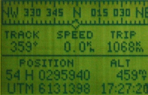
The display on the left indicates a reference of 295940 / 6131398. As the CFS Map Book is a scale of 1:50,000, with grids 1km square, the last 2 digits are discarded, with the next three digits, reading right to left, becoming the reference.
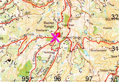
These figures, 959 / 313 then translate to the map book, by reading the Eastings first (top numbers), which increase the further East you travel, so use the numbers that are on the top or bottom of the page, then the Northings (lower numbers) which increase going North by using the numbers along the sides of the page.
X marks the spot on the map where the GPS says we should be. Simple as that.
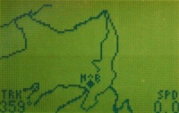
There are many models of GPS available Australia wide, but the basic principals apply to all of these units. Most will incorporate a display of where you have been, which can be downloaded to a computer, used for determining the fireground perimeter, or assisting in finding your way off a fireground in unfamilar areas.

Photographs on this page taken by Ashley Hosking, CFS Promotions Unit


