 General InformationA Short HistoryInsigniaFunctional StructureCFS HQ Functions
 Operational Services
 Regional AreasState Air DeskState Coordination CentreState Intell CellState Ops Call CentreTraining ServicesOperations PlanningPrevention ServicesPublic AffairsInfrastructure & LogisticsCFS FoundationCFSVA
![]()

")


![]()

This work is licensed under a Creative Commons Attribution-ShareAlike 4.0 International License


Operations Services
Coordination of Service Delivery - Regions
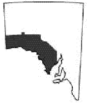
The state of South Australia is divided into 6 CFS Regions. The support for the Regional Offices is based within the Emergency Services Headquaters complex and provides the administration and planning throughout the state to ensure a coordinated command and control structure.
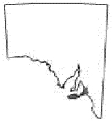
CFS Region One Region One covers 10 000 square kilometres of the Adelaide Hills, Fleurieu Peninsula and Kangaroo Island with a population base exceeding 250 000 people. The Region also includes the Greater Mount Lofty Park, Yurrebilla, National parks and forestry reserves. The Region offers great diversity from urban interface surrounding Adelaide to rural activities including cropping, viticulture and grazing. The Region has a large percentage of volunteers and the highest percentage of incidents within the state. |
 |
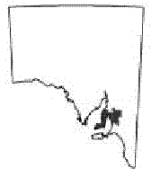
CFS Region Two Region Two covers about 17 000sq km and includes the Mt Lofty Ranges north of the Torrens River, Mid North, Clare Valley and Yorke Peninsula areas of South Australia. Land use varies from agriculture, vineyards, wine production, manufacturing, national parks, commercial forestry and urban/rural living. |
 |
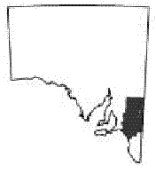
CFS Region Three Region Three (Murraylands and Riverland) is a diverse region, covering 54 000 square kilometres. The Region's agricultural pursuits vary from dryland cropping and grazing to large areas of irrigated fruit, wine and vegetables. Apiarists are active in a number of parks areas within the Region. Tourism within the area continues to flourish, with an annual increase in houseboats and the potential for associated problems. The number of vehicles passing through and visiting the Region contributes towards the overall number of highly traumatic incidents, particularly on the Dukes Highway which is a cause for concern. |
 |
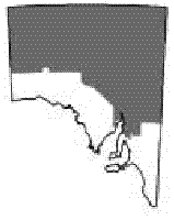
CFS Region Four CFS Region Four covers the Mid North, Flinders, North and North West Pastoral areas (approximately 700 000 square kilometres or 66 per cent of the state). Region 4 has the Flinders Ranges running through the Region and is known for sheep, cattle and grain production. Mining also takes place in the northern areas of the Region. |
 |
CFS Region Five CFS Region Five covers about 20,000 square kilometres of the state, with a population of 70 000 people. In general terms it covers the Upper and Lower South East. With reliable rainfall and abundant underground water, the Region has a strong history as a wealthy agricultural area. It is claimed the wine growing district between Penola and Padthaway, is Australia's premier wine growing district due to a favourable combination of soils and climate. There has been recent rapid expansion of both viticulture and other horticulture. The South East of South Australia represents 85 per cent of the states forests and is a $1.7 billion dollar industry with an annual growth rate of two per cent each year. The Region has a history of significant fires and other emergencies that impact on the community. In general terms, the community faces increasing risks as economical growth continues with industry expansion. |
 |
CFS Region Six Region Six occupies an area of about 188 000 square kilometres, which is twenty per cent of South Australia's land mass, with a population of 33 000 people. The major road network in the Region is the National Highway One that runs East/West across the north of the Region. The Eyre Highway is the main conduit for heavy freight vehicles, passenger coaches, tourists towing caravans and single light vehicles linking the eastern states and Western Australia. At present, more than of 140 000 vehicles travel along the Highway each year. It is predicted commercial and tourist traffic will increase significantly over the next decade. |
 |
Extract from the CFS Annual Report 2003-2004